Oklahoma’s susceptibility to tornadoes has made it a focal point in weather discussions for decades. At WHY.EDU.VN, we aim to unravel the reasons behind this phenomenon by examining the unique atmospheric conditions and geographical factors that contribute to the high frequency of tornado occurrences, offering clear and reliable explanations. Delve into the science of severe weather and learn why Oklahoma is often at the heart of tornado alley, enhancing your understanding with meteorological insights and safety awareness with the help of educational resources and expert analysis.
1. Understanding Tornado Alley and Oklahoma’s Location
The term “Tornado Alley” often comes up when discussing severe weather, but what exactly is it and why is Oklahoma right in the middle of it? Tornado Alley is a loosely defined region of the United States where tornadoes are most frequent. It generally includes states like Texas, Oklahoma, Kansas, Nebraska, and parts of Iowa, but the boundaries aren’t set in stone.
1.1. Defining Tornado Alley
While there’s no official definition, Tornado Alley is typically associated with the Great Plains region. The reason for this concentration of tornadoes lies in the area’s unique geography and climate. The flat, open terrain allows for the collision of different air masses without significant obstruction.
1.2. Oklahoma’s Geographical Position
Oklahoma’s position within Tornado Alley is a key factor in its high tornado count. It sits at a crossroads where warm, moist air from the Gulf of Mexico meets cold, dry air from Canada and the Rocky Mountains. This clash of air masses creates the perfect conditions for severe thunderstorms, which are the parent storms of tornadoes.
Oklahoma’s geographical location within Tornado Alley, with its flat terrain and convergence of diverse air masses, significantly contributes to the state’s high frequency of tornado occurrences.
2. The Atmospheric Ingredients for Tornado Formation
To understand why Oklahoma experiences so many tornadoes, it’s crucial to delve into the specific atmospheric conditions that lead to their formation. Several key ingredients must come together to create the volatile mix that spawns these destructive forces of nature.
2.1. Moisture from the Gulf of Mexico
The Gulf of Mexico plays a vital role by providing a constant source of warm, moist air. This moisture-rich air mass flows northward, particularly during the spring and early summer, and is crucial for fueling thunderstorms. The increased water vapor in the atmosphere leads to greater instability and energy, which are essential for storm development.
2.2. Cold, Dry Air from the North
Simultaneously, cold, dry air masses often push southward from Canada. This cold air is denser than the warm, moist air, causing it to sink and wedge under the warmer air. This process creates a highly unstable atmosphere, with warm air rising rapidly over the cold air.
2.3. Warm, Dry Air from the Southwest
Adding to the complexity, warm, dry air masses from the desert Southwest can also play a role. This air mass, known as the “cap,” can initially suppress thunderstorm development. However, if the cap is broken, the sudden release of energy can lead to explosive storm growth.
2.4. Wind Shear: A Crucial Element
Wind shear is a critical ingredient for tornado formation. It refers to the change in wind speed and direction with height. In environments conducive to tornadoes, winds at the surface might be blowing from the southeast, while winds higher up in the atmosphere are blowing from the southwest. This difference in wind direction creates a horizontal rolling effect in the atmosphere.
The convergence of warm, moist air from the Gulf of Mexico, cold, dry air from the north, and warm, dry air from the southwest, combined with strong wind shear, creates a highly unstable atmospheric environment in Oklahoma, fostering the development of severe thunderstorms and tornadoes.
2.5. The Development of Supercells
When all these ingredients come together, the stage is set for the development of supercell thunderstorms. Supercells are characterized by a rotating updraft called a mesocyclone. This rotation is caused by the wind shear mentioned earlier. If the mesocyclone strengthens and stretches vertically, it can eventually lead to the formation of a tornado.
3. The Science Behind Tornado Formation
Understanding the science behind tornado formation involves delving into the dynamics of supercell thunderstorms and the processes that lead to the development of a tornado from a mesocyclone.
3.1. Mesocyclone Formation
As mentioned earlier, wind shear creates a horizontal rolling effect in the atmosphere. The updraft of a thunderstorm can tilt this rolling air vertically, creating a rotating column of air called a mesocyclone. This mesocyclone is typically several miles wide and can extend high into the storm.
3.2. The Role of the Rear Flank Downdraft (RFD)
The rear flank downdraft (RFD) is a critical component in tornado formation. It is a descending current of air that develops on the backside of the supercell. The RFD helps to tighten the rotation of the mesocyclone and bring it closer to the ground.
3.3. Tornado Genesis: From Mesocyclone to Tornado
The exact mechanisms that lead to tornado formation are still not fully understood, but scientists believe that the RFD plays a crucial role. As the RFD intensifies, it can create a region of low pressure near the ground. This low pressure, combined with the rotating mesocyclone, can cause the air to rush inward and upward, further tightening the rotation and eventually forming a tornado.
3.4. The Fujita and Enhanced Fujita Scales
Tornadoes are classified based on the damage they cause using the Fujita (F) scale and the Enhanced Fujita (EF) scale. These scales estimate wind speeds based on the observed damage to structures and vegetation. The EF scale is a more refined version of the original F scale, taking into account different construction types and providing more accurate wind speed estimates.
| Scale | Estimated Wind Speed | Typical Damage |
|---|---|---|
| EF0 | 65-85 mph | Minor damage; broken branches, damaged signs |
| EF1 | 86-110 mph | Moderate damage; roofs peeled, mobile homes overturned |
| EF2 | 111-135 mph | Considerable damage; roofs torn off, trees snapped |
| EF3 | 136-165 mph | Severe damage; walls collapsed, cars lifted |
| EF4 | 166-200 mph | Devastating damage; well-constructed houses leveled |
| EF5 | Over 200 mph | Incredible damage; complete destruction of structures |

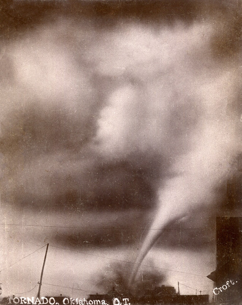
4. Historical Tornado Events in Oklahoma
Oklahoma has a long and tragic history of devastating tornadoes. Examining some of the most significant events can help illustrate the power and unpredictability of these storms.
4.1. The Woodward Tornado of 1947
On April 9, 1947, a massive tornado struck Woodward, Oklahoma, killing over 100 people and causing widespread destruction. The tornado was estimated to be an F5 on the Fujita scale, with winds exceeding 200 mph. The devastation was so complete that it took years for the town to recover.
4.2. The Snyder Tornado of 1905
Another of Oklahoma’s deadliest tornadoes occurred on May 10, 1905, in Snyder. This tornado also killed over 100 people and destroyed much of the town. The lack of adequate warning systems at the time contributed to the high death toll.
4.3. The Oklahoma City Tornado Outbreak of 1999
May 3, 1999, is a date that will forever be etched in the memory of Oklahomans. On this day, a series of powerful tornadoes struck the Oklahoma City metropolitan area, including an F5 tornado that produced the highest wind speeds ever recorded on Earth, estimated at over 300 mph. The outbreak killed 44 people, injured hundreds more, and caused billions of dollars in damage.
4.4. The Moore Tornado of 2013
On May 20, 2013, a devastating EF5 tornado struck Moore, Oklahoma, killing 24 people and causing catastrophic damage. The tornado was over a mile wide and remained on the ground for nearly 40 minutes, tearing through homes, schools, and businesses.
5. Advancements in Tornado Forecasting and Detection
Over the years, significant advancements have been made in tornado forecasting and detection, helping to improve warning times and reduce casualties.
5.1. Doppler Radar Technology
Doppler radar has revolutionized tornado detection. Unlike traditional radar, Doppler radar can detect the motion of raindrops and other particles in the atmosphere. This allows meteorologists to identify the rotating motion within a supercell thunderstorm, providing early warning of potential tornado formation.
5.2. The National Weather Service (NWS) and Storm Prediction Center (SPC)
The National Weather Service (NWS) and the Storm Prediction Center (SPC) play critical roles in forecasting and issuing tornado watches and warnings. The SPC monitors weather conditions across the country and issues tornado watches when conditions are favorable for tornado development. Local NWS offices then issue tornado warnings when a tornado has been sighted or indicated by radar.
5.3. Public Warning Systems
Public warning systems, such as sirens, emergency alerts on television and radio, and mobile phone alerts, are essential for disseminating tornado warnings to the public. These systems provide critical information that can help people take shelter and protect themselves from approaching tornadoes.
5.4. The Role of Storm Chasers
Storm chasers play a valuable role in tornado research and warning. These dedicated individuals venture out into severe weather to observe and document tornadoes, providing real-time information that can help meteorologists improve their forecasts and warnings.
6. Oklahoma’s Unique Geography and Its Impact on Tornadoes
Oklahoma’s unique geographical features contribute significantly to its high tornado frequency. The state’s location in the heart of the Great Plains, combined with its varied topography, creates an environment conducive to severe weather.
6.1. The Flat Plains and Unobstructed Airflow
The flat, open plains of Oklahoma allow for the unobstructed flow of air masses. This lack of significant terrain features means that there are few barriers to disrupt the collision of warm, moist air from the Gulf of Mexico and cold, dry air from the north.
6.2. The Influence of the Rocky Mountains
The Rocky Mountains, located to the west of Oklahoma, also play a role in the state’s weather patterns. The mountains can help to channel cold air southward, increasing the temperature gradient and instability that lead to severe thunderstorms.
6.3. Soil Moisture and Vegetation
Soil moisture and vegetation cover can also influence tornado formation. Dry soil can lead to higher surface temperatures, which can increase instability in the atmosphere. Additionally, sparse vegetation cover can reduce friction, allowing air masses to move more freely.
7. Climate Change and Tornado Activity in Oklahoma
The potential impact of climate change on tornado activity is a topic of ongoing research. While there is no definitive consensus, some studies suggest that climate change may alter the frequency and intensity of severe thunderstorms and tornadoes.
7.1. Potential Changes in Atmospheric Conditions
Climate change could lead to changes in temperature and moisture patterns, which could affect the ingredients necessary for tornado formation. Some models suggest that the area favorable for severe thunderstorms may shift eastward, potentially impacting the traditional Tornado Alley region.
7.2. The Impact on Tornado Intensity
It is also possible that climate change could influence the intensity of tornadoes. Warmer temperatures could lead to more instability in the atmosphere, potentially resulting in stronger and more destructive tornadoes.
7.3. Ongoing Research and Uncertainties
The relationship between climate change and tornado activity is complex and not fully understood. More research is needed to determine the long-term impacts of climate change on severe weather patterns.
8. Preparing for Tornadoes: Safety Measures and Precautions
Given the high frequency of tornadoes in Oklahoma, it is essential to be prepared and know how to respond when a tornado threatens.
8.1. Understanding Tornado Watches and Warnings
A tornado watch means that conditions are favorable for tornadoes to develop in the area. During a tornado watch, it is important to stay informed, monitor weather updates, and have a plan in place in case a tornado warning is issued. A tornado warning means that a tornado has been sighted or indicated by radar and poses an immediate threat.
8.2. Seeking Shelter: Safe Rooms and Underground Shelters
The safest place to be during a tornado is in an underground shelter or a safe room. A safe room is a reinforced structure designed to withstand tornado-force winds. If an underground shelter or safe room is not available, the next best option is to seek shelter in an interior room on the lowest level of a sturdy building, away from windows.
8.3. Developing a Family Emergency Plan
It is important to develop a family emergency plan that includes a designated meeting place, communication strategies, and a supply kit with essential items such as water, food, medications, and a weather radio.
8.4. Staying Informed: Weather Radios and Mobile Alerts
Staying informed about weather conditions is crucial during severe weather events. Weather radios provide continuous updates from the National Weather Service, and mobile alerts can deliver timely warnings directly to your phone.
9. Community Efforts and Tornado Preparedness
Community efforts play a vital role in tornado preparedness and response. Local organizations, schools, and government agencies work together to educate the public, provide resources, and coordinate emergency response efforts.
9.1. Educational Programs and Outreach
Educational programs and outreach initiatives help to raise awareness about tornado safety and preparedness. These programs often include presentations, workshops, and drills that teach people how to recognize the signs of a tornado and how to respond appropriately.
9.2. Community Shelters and Safe Spaces
Many communities have established public shelters and safe spaces where people can seek refuge during a tornado. These shelters are typically located in schools, churches, or other sturdy buildings and are designed to provide protection from tornado-force winds.
9.3. Emergency Response Teams and Volunteers
Emergency response teams and volunteers are essential for providing assistance to those affected by tornadoes. These individuals help with search and rescue efforts, provide medical care, and distribute supplies to those in need.
10. The Future of Tornado Research and Prediction
Tornado research and prediction continue to evolve, with scientists working to improve our understanding of these complex weather phenomena and develop more accurate forecasting methods.
10.1. Advanced Modeling and Simulation Techniques
Advanced modeling and simulation techniques are being used to study the dynamics of supercell thunderstorms and the processes that lead to tornado formation. These models can help scientists to better understand the factors that influence tornado intensity and duration.
10.2. Improved Radar Technology and Data Analysis
Improved radar technology and data analysis techniques are enhancing our ability to detect and track tornadoes. Phased array radar, for example, can scan the atmosphere much faster than traditional radar, providing more detailed information about storm structure and movement.
10.3. Collaboration and Data Sharing
Collaboration and data sharing among researchers, meteorologists, and emergency management agencies are crucial for advancing tornado research and prediction. By sharing data and insights, these professionals can work together to improve our understanding of tornadoes and develop more effective warning systems.
Oklahoma’s vulnerability to tornadoes is a result of its unique geographical location and the confluence of specific atmospheric conditions. While the threat of tornadoes is a constant reality for Oklahomans, advancements in forecasting, detection, and preparedness are helping to reduce the risk and improve safety.
Do you have more questions about severe weather or other complex topics? Visit why.edu.vn at 101 Curiosity Lane, Answer Town, CA 90210, United States, or contact us via WhatsApp at +1 (213) 555-0101 to connect with our experts and get the answers you need.
FAQ: Understanding Tornadoes in Oklahoma
1. Why is Oklahoma called part of “Tornado Alley”?
Oklahoma is part of “Tornado Alley” due to its geographical location, where warm, moist air from the Gulf of Mexico meets cold, dry air from the north, creating conditions ripe for tornado formation.
2. What time of year are tornadoes most common in Oklahoma?
Tornadoes are most common in Oklahoma during the spring months, particularly from April to June, when atmospheric conditions are most favorable.
3. How does wind shear contribute to tornado formation?
Wind shear, the change in wind speed and direction with height, creates a horizontal rolling effect in the atmosphere that can be tilted vertically by thunderstorm updrafts, leading to the formation of rotating mesocyclones.
4. What is a supercell thunderstorm?
A supercell thunderstorm is a type of thunderstorm characterized by a rotating updraft called a mesocyclone, which can lead to the formation of tornadoes.
5. How has Doppler radar improved tornado forecasting?
Doppler radar can detect the motion of raindrops and other particles in the atmosphere, allowing meteorologists to identify the rotating motion within a supercell thunderstorm and provide early warning of potential tornado formation.
6. What is the difference between a tornado watch and a tornado warning?
A tornado watch means that conditions are favorable for tornadoes to develop in the area, while a tornado warning means that a tornado has been sighted or indicated by radar and poses an immediate threat.
7. Where is the safest place to be during a tornado?
The safest place to be during a tornado is in an underground shelter or a safe room. If neither is available, seek shelter in an interior room on the lowest level of a sturdy building, away from windows.
8. What is a safe room?
A safe room is a reinforced structure designed to withstand tornado-force winds, providing a safe place to take shelter during a tornado.
9. How can I stay informed about tornado warnings?
You can stay informed about tornado warnings by monitoring weather radios, local television and radio broadcasts, and mobile phone alerts.
10. What should be included in a family emergency plan for tornadoes?
A family emergency plan should include a designated meeting place, communication strategies, and a supply kit with essential items such as water, food, medications, and a weather radio.