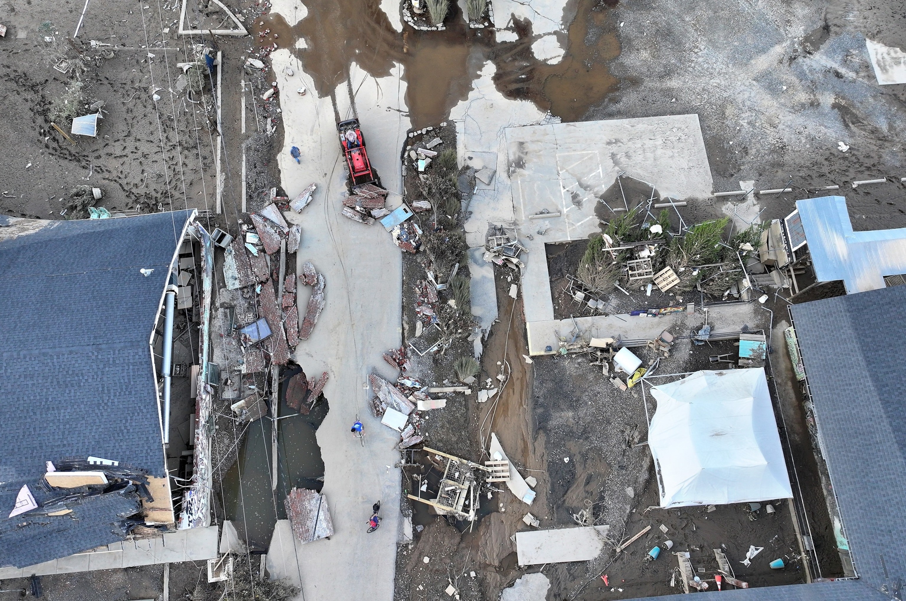
The intense flooding that devastated Asheville, North Carolina, wasn’t solely due to the remnants of Hurricane Helene. While the hurricane played a significant role, a confluence of atmospheric conditions and the region’s unique topography amplified the storm’s impact, leading to a catastrophic flash flood event. Experts explain the key factors that contributed to this extreme weather phenomenon.
The story began well before Hurricane Helene approached. The Asheville region was already saturated from days of persistent rainfall. This precursor rain event acted as a critical primer, setting the stage for the subsequent deluge. According to the North Carolina State Climate Office, some areas had already received over a foot of rain, leaving the ground unable to absorb further precipitation. Rivers and streams were swollen, nearing their capacity. This pre-existing condition meant that when the heavier rains from Hurricane Helene arrived, the region was exceptionally vulnerable to flooding.
Hurricane Helene itself, although weakening as it moved inland, still carried significant moisture. Originating as a Category 4 hurricane in the Gulf of Mexico, Helene tracked northward after making landfall, unleashing its rain shield across a wide area. This rain shield, defined as a large area of continuous rainfall that intensifies closer to the storm’s center, interacted with a pre-existing cold front. This interaction further exacerbated the rainfall in the Asheville region. Art DeGaetano, director of the NOAA Northeast Regional Climate Center at Cornell University, pointed out that large Gulf hurricanes often trigger such precursor rain events inland as their rain shields meet cold fronts.
The topography of Asheville and the surrounding Appalachian Mountains played a crucial role in escalating the flooding. The phenomenon of orographic lifting significantly enhanced rainfall. As moist air associated with Hurricane Helene was forced to ascend over the mountains, it cooled and condensed, leading to increased precipitation. Yuh-Lang Lin, a professor of atmospheric science at North Carolina Agricultural and Technical State University, explained that this orographic lift essentially squeezed additional moisture out of the atmosphere directly over the mountainous Asheville region.
Jennifer Francis, an atmospheric scientist at the Woodwell Climate Research Center, highlighted how mountainous terrain funnels rainfall into valleys and river systems. In Asheville, the French Broad River and its tributaries experienced rapid and dramatic rises, overflowing their banks and inundating nearby communities with little warning. The combination of already saturated ground and the funneling effect of the mountains transformed heavy rainfall into a devastating flash flood event.
Furthermore, the influence of climate change cannot be ignored. Warmer ocean temperatures in the Gulf of Mexico provided Hurricane Helene with more energy and moisture as it developed. This increased moisture content in the atmosphere is a direct consequence of climate change, leading to heavier rainfall events. DeGaetano noted that the warmer waters likely intensified Helene and fueled the extreme precipitation along its path. The increasing frequency and intensity of extreme rainfall events are well-documented in reports like the Fifth National Climate Assessment, which indicates a 37% increase in extreme precipitation events in the Southeast in recent decades.
Marshall Shepherd, director of the Atmospheric Sciences Program at the University of Georgia, suggested the potential contribution of an atmospheric river, adding another layer to the complex weather system. He described a “multiple-whammy” scenario involving the hurricane, orographic lifting, and a possible atmospheric river, all converging to unleash “trillions of gallons of moisture” upon the region.
Looking back, history offers a stark reminder of Asheville’s vulnerability to such events. The “Great Flood of 1916” serves as a historical parallel, demonstrating that the region’s geography and susceptibility to extreme rainfall have long posed a flood risk. The recent flooding, while caused by different specific weather systems, echoes the historical precedent and underscores the ongoing need for preparedness and resilience in the face of increasing extreme weather events.
In conclusion, the Asheville flooding was not a singular event but rather a result of several interacting factors. Pre-saturated soil, the remnants of Hurricane Helene, orographic lifting due to mountainous topography, and the overarching influence of climate change all converged to create a perfect storm scenario. Understanding these contributing elements is crucial for developing better forecasting, preparedness strategies, and long-term resilience measures to mitigate the impact of future extreme weather events in vulnerable regions like Asheville.